Short route
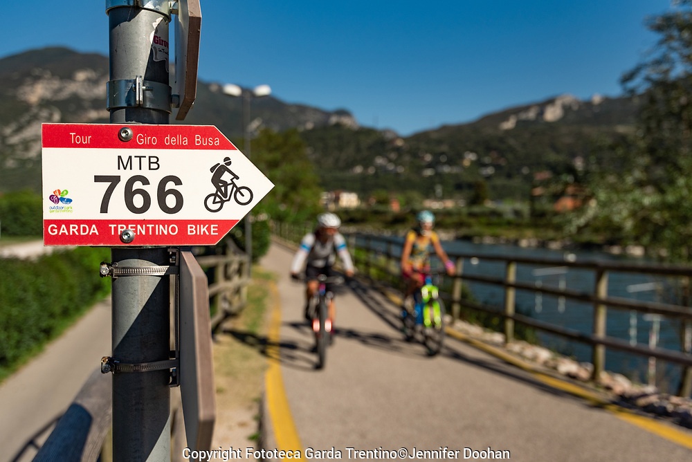
This simple tour is dedicated to families or those who want to go beyond the boundaries that define the “Busa”, the basin that surrounds the towns of Riva del Garda, Torbole and Arco, and wish to extend the excursion along the Sarca river valley in the Dro area.
The route, also suitable for those who are not used to mountain biking, is mostly flat.
Passing from Torbole we will cycle on cycle paths, tarmac country roads and a stretch along a dirt path surrounded first by olive trees and then by pine trees.
A pleasant stop in the middle of our route will allow us to admire Lake Bagatoli, a little pearl surrounded by a beautiful pine forest that extends to the foot of the very high rock wall of the Brento peak, a paradise for the most experienced rock climbers and the most daring base jumpers.
Difficulty: 2/5
Highest point: 238m above sea level
Difference in altitude: + 200m
Distance: 32-37 km
Time: ½ day (4-5 hours)
Medium route
… When you reach the crossroads for Bagattoli lake, continue on the easy forest road, at the foot of Monte Brento in the direction of Pietramurata. On the last part of this segment, we will find a short climb, rather bumpy and with a slightly exposed passage on the peak.
Once we reach the town of Pietramurata we will be immersed in the Sarca vineyards where Nosiola, a local white wine, is produced. (opportunity to visit the winery… ..)
The shores of Lake Cavedine will be the destination of our tour where a break lying in the sun will regenerate us for a quick return only on cycle paths.
Difficulty: 2,5 / 5
Highest point: 238m above sea level
Difference in altitude: + 350m
Distance: 42-47 km
Time: ½ day (4-5 hours)
Complete route
… from the center of Pietramurata we head north along a pleasant cycle path that runs alongside the Sarca river to the similarly named village of “Sarche” which is also the final destination of our tour where we will stop at the Hosteria Toblino where you can taste and buy local products.
The return on an easy secondary road through vineyards and orchards will lead us along Lake Cavedine until we get to the “Marocche” viewpoint, a large and sunny expanse of post-glacial rocks, formed about 200,000 years ago, during the phases of the withdrawal of the glaciers.
From here an easy descent on a tarmac road will lead us to the cycle path that will take us back home.
Difficulty: 3/5
Highest point: 250m above sea level
Difference in altitude: + 400m
Distance: 55-60 km
Time: 1 day (5-8 hours)
For info costs and availability +39 349 8849504